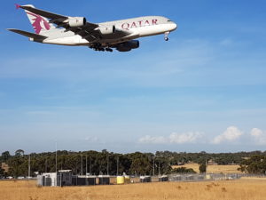
A388 arriving over the wake turbulence measurement Array at Melbourne Airport.
What Wake Watch Does.
We provide real-time atmospheric measurements for Airports & Wind Farms.
For Airports; Wind & turbulence profiles to 400m every 15 seconds,
Wind shear measurements every second to 80m, spaced up to 1000m. Temperature profile measurements to locate temperature inversions which can then advise about the location of long lived wake vortices. This capability enables full weather dependent operations providing increased runway throughput, improved resilience, and improved safety.
For Wind Farms; Remote sensing of wind and turbulence intensity (TI) profiles every 7 seconds, 10m to 200m in all weather including rain up to 5mm/hr. No interpolation required. Availability at 200m > 97%.
NOTE; This site uses email, password verification for access to our Aircraft Wake Avoidance, Wind Profiles, Turbulence & Wind Shear Detection systems as well as the Reports pages.
Our products are applicable to five key areas:
- Remote sensing, trailer mounted wind profilers with a range of 10m to 200m with high reliability for wind farms.
- Reliable wind, temperature, and turbulence profiles enabling weather dependent operations for aviation.
- Conquering the last frontier with reliable real time detection of low level horizontal and vertical wind shear and vertical turbulence with 3 second updates, leading to improved aircraft safety and runway utilization.
- Wind profiling to provide accurate real time wind information for pilots, enabling the provision of 15 minute now-casting.
- Vertical real time, high resolution stratification measurements to accurately locate any temperature inversions which can extend the lifetime of aircraft wake turbulence.
Mobile wind profilers for wind farms
The deployment of our all weather wind profilers is a simple as placing trailers without any special site preparation and does not require regulatory approval, only the approval of the land owners. The mobility and capability of the system also means that it can be used in the production phase of the development. The remote sensing capability of the wind profiler completely alleviates the need for expensive towers and overcomes the poor measurement of turbulence intensity from other systems.
With a range of 10m to 200m and 1m resolution while updating every 7 seconds our wind profilers provide accurate wind profiles over the whole turbine aperture. This measurement capability includes wind profiles and turbulence measurements which can be made during the survey period to optimize the site production and the hub height.
Delivering full weather dependent operations.
Weather has the greatest impact on airport operations because of fog resulting in poor visibility, strong winds which cause severe wind shear and turbulence, thunderstorms which cause severe wind shear, and inversion layers which result in a much greater probability of a wake vortex encounter. Being able to measure all these effects within the boundary layer with high resolution and in all weather will deliver increased runway throughput while improving resilience and safety.
Thus, further developments in MET systems and technology are essential to drive increased resilience and improved operational performance of all airports. Such developments result in less delay and better punctuality for passengers and better service for all customers. Having all the critical met data means we can make better operational decisions at an earlier stage to make best use of available capacity.
This can be achieved by the use of wind profiler driven micro-scale met models that update in real time to provide a commentary on likely impact of weather & operational restrictions. These models could be updated every 2 minutes using several all-weather wind profilers having very high spatial (2m) and temporal (15 second) resolution while being able to measure to heights from 10m to 400m to allow accurate modelling of the boundary layer. Such wind profilers have very high signal-to-noise ratios allowing then to accurately resolve temperature inversion layers and to also estimate virtual temperature profiles and other boundary layer parameters. The system is very noise tolerant, maintaining a 100m range even with aircraft directly overhead. The radiated noise is also very low at < 65dBa at 5m. An example of just such a wind profiler can be seen on the page under “Wind Profiles”. Several candidate micro-scale met models have been developed but have not been investigated by WakeWatch.
In storms there is an increased risk of crosswind gusts, turbulence, wind-shear and the associated go around/missed approach risk. These events can be managed through the use of wind profilers having very high spatial and temporal resolution and ability to operate in all weather. Such wind profilers will cover the heights from 10m to 80m where the greatest risk is present and update every few seconds. Several such wind profilers can be deployed to run synchronously over a large area and the measurements are available in real time. An example of just such a system operation can be seen on the page under “Turbulence and Wind Shear detection”.
The principal reason that spacing rules exist is to reduce the probability of an encounter with an aircraft wake vortex, especially near the ground. An improved knowledge of wake vortex behavior in the presence of temperature inversion layers can be used to safely reduce spacing to deliver increased capacity. As previous standalone wind profilers experience limitations, the application of new technology in a chirp SODAR has overcome these limitations. The wake encounter risk can thus now be properly evaluated in real time through the use of a real time wake location predictor based on the measurement of the inversion layer height.
A Few Extra Notes
An explanation of how the chirp SODAR works, “About Chirp SODAR.pdf”, is available for download in the Reports section.
NOTE; This site uses email, password verification for access to the Aircraft Wake Avoidance, Wind Profiles, Turbulence & Wind Shear Detection and Reports pages.